
Features SweMaps
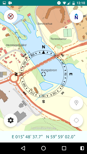
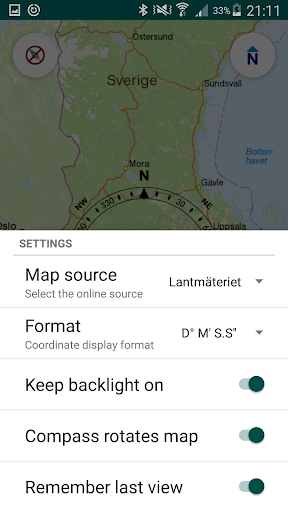
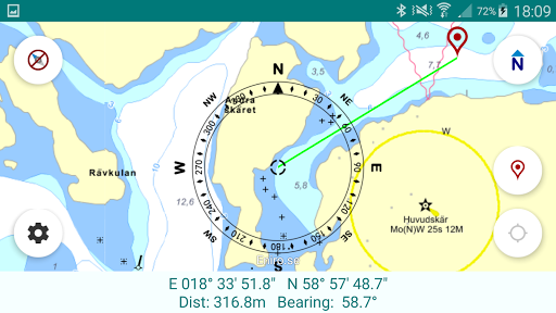
Simple map viewing app that can be used to view Swedish online map sources without having to use the browser, giving a simpler and more convenient user-experience on mobile devices.Online sources such as:Swedish topographic map (Topografisk webbkarta) from LantmäterietHitta.se (hitta.se/kartan)Eniro.se (kartor.eniro.se)OpenStreetMap (OSM) (skobbler.com)Satellite pictures of Sweden It can use the internal GPS and compass sensors to show your current location, course direction and speed.It has, "north-up" and "course-up" viewing modes.A simple waypoint can be added and the direction and distance to the waypoint will be shown.The waypoint coordinates can be changed by tapping on the waypoint marker.
This app is free, and also ad-free.There will later be an extended paid version.
(At least, that is the plan...)It requires:Internet access to download the online mapsLocation permission if you want it to display your current location (speed, and direction)Please note: it cannot download maps for offline use (but it does cache the map tiles temporarily, so you dont have to keep downloading areas that was viewed recently)
Gaming Features
Enjoy immersive gaming experience with various game modes.
Weather Features
Get accurate weather forecasts and real-time updates.
Fitness Tracking
Track your workouts and monitor your health metrics.
See the SweMaps in Action
Get the App Today
Available for Android 8.0 and above